Stay Sky Aware Today As Rice County At Risk For Severe Weather
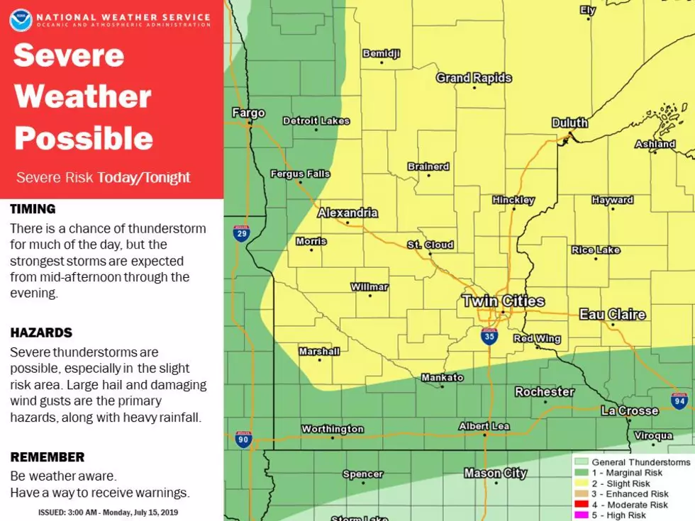
Last night central and northern Minnesota got the brunt of the severe weather with counties like Aitkin and Morrison having wind, rain, hail, and tornado warnings. The National Weather Service tweeted out their severe weather risk map this morning and northern Rice County is located in the higher risk area of the map. Stay sky aware today, especially for those setting up booths and stands at the Rice County Fairgrounds this afternoon.
If the risk for severe weather wasn't enough for you there is also a heat advisory in effect until 10pm tonight for the 7 county metro area which includes cities like Apple Valley, Burnsville, Northfield, and Prior Lake. Temps will be in the upper 80s to lower 90s with a heat index value in the upper 90s to low 100s.

A hazardous weather outlook was issued for multiple counties with the risk for severe weather and high heat and humidity through Wednesday. Part of the outlook stated:
"Heat and humidity, along with periodic thunderstorm chances, will persist through Wednesday. A few severe thunderstorms are possible over that time period. Any storms that develop will also be capable of producing locally excessive rainfall." - NWS Hazardous Weather Outlook
The best way to stay on top of the weather no matter where you are is with our FREE app, download it today and be weather aware.
More From KDHL Radio