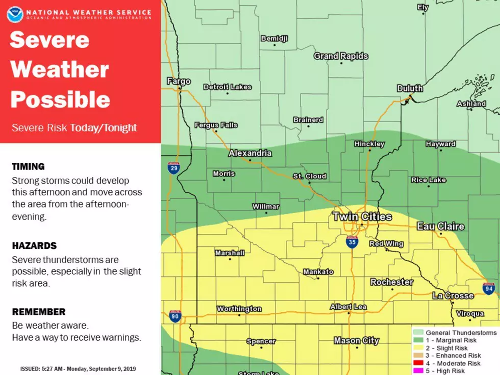
Possibility of Severe Weather This Afternoon Across SE Minnesota
It definitely didn't feel like summer, or that we could have potentially severe weather, this weekend with highs on Sunday reaching the upper 50's. But the National Weather Service in the Twin Cities has put most of southern and southeastern Minnesota in a zone of slight risk for severe weather tonight.
The National Weather Service in the Twin Cities has the potential for severe weather set for today into tonight with the possibility of strong storms developing this afternoon and moving along southern Minnesota into this evening.
The rain amounts are again an estimate as it all depends on atmospheric conditions. It seems like when we are guaranteed a chance of rain, we don't get as much as predicted.
The wet weather and possible severe weather comes at an awkward time for the National Weather Service in the Twin Cities as their radar unit will be down for upgrades for the next three weeks. The NWS will utilize other area radar stations in order to see what is happening across much of Minnesota during that time.
More From KDHL Radio


![Carrie Underwood + Joan Jett Rock 2019-2020 ‘Sunday Night Football’ Opening [WATCH]](http://townsquare.media/site/623/files/2019/09/carrie-underwood-joan-jett-snf-2019.jpg?w=980&q=75)