Another Hot Day On Tap Today, Severe Weather Possible Tonight
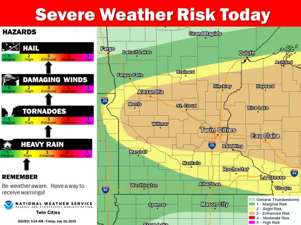
This is usually the hottest week of the year in Minnesota, and this week is no different this year. Yesterday was a hot and sticky day, a light breeze appeared for a little bit in the afternoon, but the sun was shining and people were drinking plenty of water and Gatorade at the fairgrounds. Today is looking like another hot and steamy day. The National Weather Service has Rice County in a Slight Risk area for severe weather tonight and in an excessive heat warning until 10pm tonight.
The National Weather Service in the Twin Cities tweeted out this morning that today could be the hottest day of the year!
The Rice County Fairgrounds will have heat indices in the triple digits with it feeling like 105 later on today. Be sure to drink plenty of fluids like water or Gatorade, and avoid long periods of being outdoors.
The National Weather Service Twin Cities also issued a hazardous weather outlook for today that said:
"Strong to severe thunderstorms are expected this afternoon and evening. Large hail, damaging winds and tornadoes are the primary threats, along with heavy rainfall. In advance of the thunderstorms, heat and humidity will build across much of the area. Heat indices from 100 to 110 are expected during the afternoon and early evening hours across central and southern Minnesota and west central Wisconsin." - NWS Twin Cities
Be sure to stop on out at the fair tonight for some 'Deal or No Deal' we are expecting to start at 6pm you can start signing up to play at 5pm at the KDHL/Power 96 house across from the BA Cardinal Cafe. You might walk away with Vikings pre-season tickets!
More From KDHL Radio