Sweet Relief From Arctic Temps Brings A Chance For More Snow
Well, winter can end any day now. I don't really mean that as a bunch of snowmobile trails just opened up on the 1st of December. Those trails might be getting some additional snow cover as the Arctic air moves on, and a chance for measurable snow comes in. Faribault and Owatonna won't see much, maybe a trace to an inch of snow, but further to our East and Southeast the chance for more snow grows.
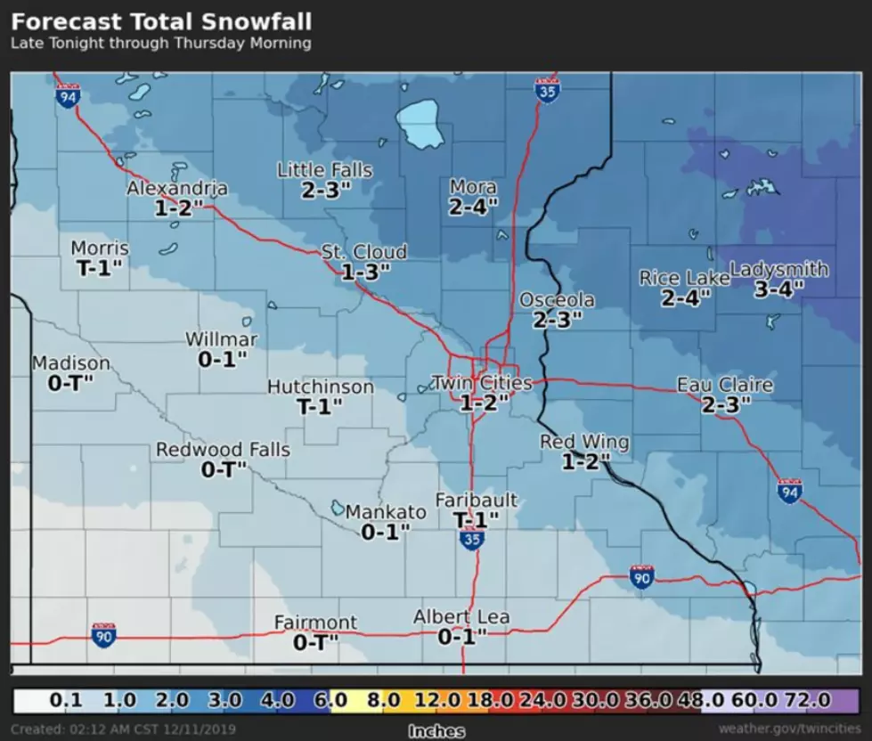
According to the National Weather Service in the Twin Cities, a "quick moving system will bring a round of snow into the area tonight through Thursday morning".
The National Weather Service has Steele, Waseca, LeSueur, and Dodge Counties squarely in the trace to an inch of snow area on their map, Rice and Olmsted Counties are split between a trace to 2 inches of snow, while Goodhue County looks to be receiving possibly the most a snow, based on early forecasting models.

The snow, of course, is coming on the heels of an arctic cold front that has been sitting on the #BoldNorth since Monday night. Windchills this morning ranged between -18 in Albert Lea to -31 in St Cloud.
Today's high temps aren't expected until close to midnight tonight.

More From KDHL Radio