NEW: Minnesota Severe Storm Alerts Now Include Potential Damage Info

Living in Southeastern Minnesota you know weather can be unpredictable in the winter and the summer (to say the least) and severe. But all severe storms are not the same, so starting August 2, 2021, the National Weather Service (NWS) added a "damage threat" to Severe Thunderstorm Warnings (like they do for Tornado and Flash Flood Warnings).
There Are Three Categories of Severe Thunderstorm Warning Damage

According to the NWS,
The criteria for a destructive damage threatthunderstorm
- The criteria for a considerable damage threat is at least 1.75 inch diameter (golf ball-sized) hail and/or 70 mph thunderstorm winds. This will not activate a WEA.
- The criteria for a baseline or “base” severe thunderstorm warning remains unchanged, 1.00 inch (quarter-sized) hail and/or 58 mph thunderstorm winds. This will not activate a WEA. When no damage threat tag is present, damage is expected to be at the base level.
Nationwide, only 10% of all severe thunderstorms reach a destructive level. Most of us likely remember the "costliest thunderstorm in U.S. history, the $11 billion derecho that affected Iowa in August 2020."

Learn how to stay safe in a severe thunderstorm by clicking here.
As always, if you have a comment, complaint, or concern about something I wrote here, please let me know: james.rabe@townsquaremedia.com
Do you remember the Derecho in Iowa?
From August 19, 2020 -
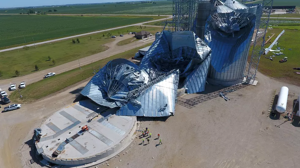
New Estimate of 140 MPH Derecho Gust in Cedar Rapids
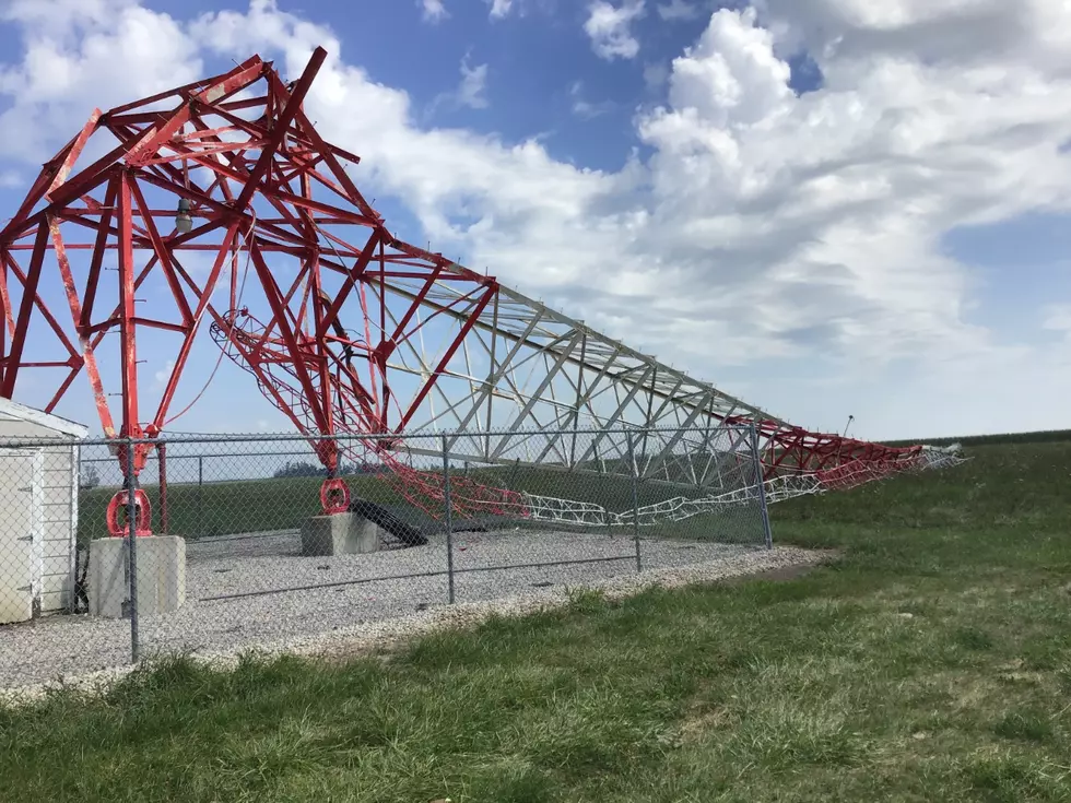
Cedar Rapids, IA (KROC-AM News) - The National Weather Service is now estimating that wind gusts around 140-miles-per-hour hit sections of Cedar Rapids, during last week's catastrophic Derecho wind storm.
The updated estimate is based on an inspection of the damage to an apartment complex in the southwest part of the eastern Iowa city. The National Weather Service says that is comparable to the winds produced by an EF-3 tornado.
(Courtesy of Kip Ladage)
While the 140 mile-per-hour gust is an estimate, the National Weather Service is also reporting there was a measured gust of 126-miles-per-hour in the town of Aitkin just west of Cedar Rapids. That set a new record for the highest non-tornado wind ever recorded in Iowa.
The National Weather Service website says the previous record of 123-miles-per-hour was recorded in an area south of Cedar Rapids when another devastating Derecho ripped across Iowa on June 29, 1998.
Mid September 2018 A Twister Near Zumbrota
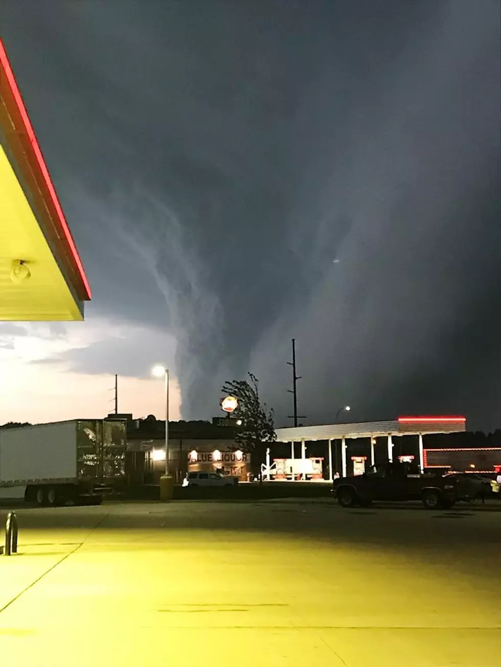
As reported on KROC NEWS...
According to reports from the National Weather Service, the most severe weather and damage was in an area from Faribault, Owatonna and Waseca, through West Concord, Northfield and Cannon Falls, and Red Wing.
The reports include damaged or destroyed buildings, large numbers of downed trees and power outages. Significant damage was reported at the Faribault airport. Winds gusts up to 70 mph were reported in the storm zone as were several suspected tornadoes.
Below are some of the pictures submitted by listeners.
The Storm - 09-20-18
Listen to James Rabe Monday, Wednesday, and Friday from 11-Noon on KROC AM 1340 and 96.9 FM and Weekdays with Jessica Williams Weekday from 6 - 10 AM on Y-105 FM
Photos Of Duluth's July 2016 Devastating Wind Storm
Gallery Credit: Ken Hayes
LOOK: The most expensive weather and climate disasters in recent decades
Gallery Credit: KATELYN LEBOFF
More From KDHL Radio