
Crazy: Hurricane Hilary May Hit Los Angeles as tropical storm by Monday
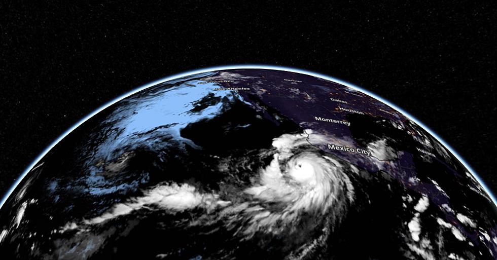
May you live in interesting times, the proverb goes (and it's probably not a compliment). By now you know about the record hot summer much of the planet is experiencing, including record warmth in our oceans. Some of that is the result of El Nino warming in the Pacific, which may add more fuel and strengthening for "Hilary", which is now a hurricane, and forecast to track up the Pacific coast of Baja Mexico in the coming days. And yes, it poses considerable risk to southern California.
Who had THAT on their 2023 Weather Bingo Card?
Tropical cyclones impacting southern California are exceedingly rare. Why? Tropical systems get their energy, their "fuel" from warm ocean water, and due to "upwelling" the water off the coast of San Diego and Los Angeles is usually too chilly to support tropical storms and hurricanes. The last tropical storm hit Long Beach, California in 1939 and Tropical Storm "Jen-Kath" came within 100 miles of San Diego and L.A. in 1963.
Odds favor that "Hilary" will become post-tropical by the time the center of the storm approaches southern California Sunday due to cooler ocean water. The primary risk is not wind or storm surge, but flash flooding, wit 2-6" of rain, in some cases 1-2 year's worth of rain falling in 2 or 3 days. Some of that flooding may impact San Diego and Los Angeles this weekend, and there is now little doubt that this will be an historic weather event for SoCal.
Flash flooding well inland may be catastrophic, especially from the deserts east of San Diego into western Arizona and even the Las Vegas area, as the soggy remains of Hilary come ashore. It's still early for specifics, but Hilary may have a silver lining: providing precious rains and helping to break triple-digit heat gripping the Desert Southwest.
There is considerable uncertainty about the exact track, but most weather models, including NOAA's high-resolution tropical models, show the center of Hilary just south of Tijuana, Mexico by Sunday night, probably at tropical storm strength with sustained winds over 39 mph. The storm should weaken rapidly as it comes ashore in southern California with diminishing winds, but the flood threat will remain hundreds of miles inland.
While much of the central US and Midwest simmers through extreme heat, the most impactful tropical system in 84 years will impact California and the Desert Southwest, more evidence of a weather pattern on steroids.
We get soul-sucking winters some years, but at least we don't see storms with names.
Small comfort, but remember, the weather can always be worse.