Check Out All Of The Ice And Snow Stacked Up In Duluth’s Canal Park [PHOTOS]
Powerful wind and waves battered the Duluth shoreline on Tuesday as a late-season winter storm battered the region. The messy storm included blizzard conditions in parts of Minnesota, a glaze of ice, thunderstorms, snow, and strong wind gusts up to nearly 70 MPH.
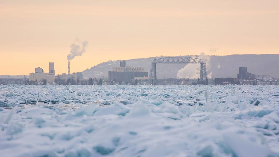
Due to concerns about strong waves propelled by those windy conditions, there was a lakeshore flooding advisory put out by the National Weather Service for a part of Tuesday. That advisory was eventually canceled as a cushion of packed ice and snow chunks congregated along the Lake Superior shoreline, including Duluth's Canal Park and Park Point.
MORE: See top wind gust speeds recorded around the Northland Tuesday
What was left behind on Wednesday morning was an impressive sheet of pulverized icy debris that extended from within the canal to a few hundred yards into the lake.

One of the things that was kind of surreal was just how calm the surface was Wednesday morning, despite a breeze off the lake. In the video below, showing the harbor side of the lift bridge, the sheet of pieces of ice and snow doesn't even appear to be moving - a stark difference to the rolling waves under this same ice and snow on Tuesday.
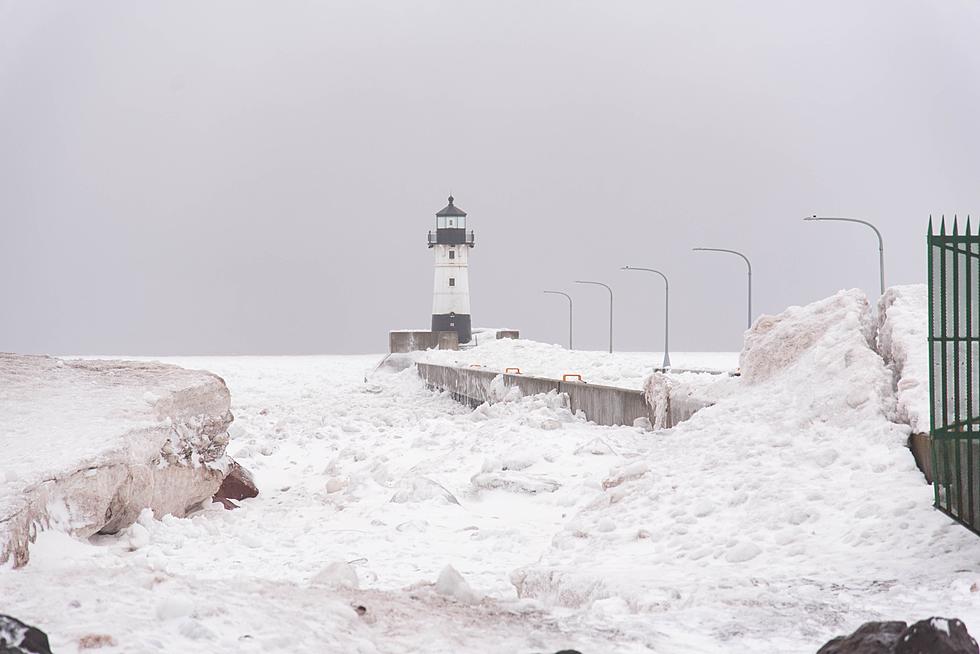
Those waves threw chunks of ice and snow onto portions of the Canal Park piers, leaving piles several feet tall within the pier walls. Additionally, the Canal Park shoreline is now plastered with a layer of caked-on snow and ice, left behind by waves battering against the shoreline on Tuesday.
You can see the aftermath of the scene in the photos below.
Sea Of Snowy Ice Chunks Left Behind By Wind & Waves In Duluth's Canal Park
Gallery Credit: Nick Cooper - TSM Duluth
The 15 Snowiest Winters On Record In Duluth History
Gallery Credit: Nick Cooper - TSM Duluth
More From KDHL Radio