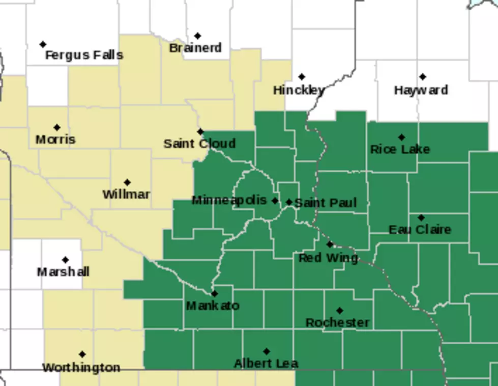
Local Weather

Heat Advisory
Heat Advisory
Heat Advisory
The heat index will approach or exceed 95 to 100 degrees across much of east central through south central Minnesota today. Strong southwesterly winds of 25 to 35 mph with gusts to 50 mph are expected over much of southwestern and south central Minnesota today...
Area Snow Amounts
Area Snow Amounts
Area Snow Amounts
According to the national weather service here are some snowfall totals for the area as of 8:15pm Sunday: Rochester 4" Owatonna 4" Faribault 4" LeCenter 3.8" Burnsville 3.5" Kenyon 3.2" Hayfield 3" Mantorville 2.5" A winter storm warning remains in effect for a large portion of southern Minnesota...
Foggy Tuesday
Foggy Tuesday
Foggy Tuesday
With the rain Monday and warm weather, we have a lot of dense fog around the area for Tuesday morning. You need to use caution as visibility can drop to 1/4 mile or less in a hurry. So reduce your speeds, and give yourself extra time to get where you need to go Tuesday morning...
Flash Flood Watch for Our Area
The National Weather Service has posted a flash flood watch from 10PM Tuesday night through Thursday evening. Minnesota counties included are Sibley, Scott, Dakota, Brown, Nicollet, Le Sueur, Rice, Goodhue, Watonwan, Blue Earth, Waseca, Steele, Martin, Faribault and Freeborn and in Wisconsin, Pierce, Pepin and Eau Claire counties...
Flood Watch For The Area
Strong thunderstorms are moving through the area this afternoon and more rain is in the forecast. So a flash flood watch continues for most of the area until 1AM Thursday morning. More than 1-2 inches of rain has been reported already and the weather service says the area could see anywhere from another 2 inches to as much as 6 inches by Thursday...
Severe Weather Tuesday?
Update: Even though some showers and thunderstorms are moving through Scott, Dakota, Le Sueur and Rice Counties it looks dry in Steele County so far and it's going to be a great kickoff for the Steele County Fair in Owatonna. The National Weather Service does say that there is a chance of some showers and thunderstorms developing and some could be severe, with large hail and damaging winds and hea
Area Rainfall Totals
The flash flood watch continues for the area until 1AM Friday. There could be redevelopment of storms later today. Some storms again could be severe with heavy rains, that's why the flood watch remains in effect. Most of the area had rainfall totals of anywhere from 2-6 inches...
Twins And Storm Update
Update: The Minnesota Twins game has been postponed due to the weather. They will, weather permitting, play what was going to be the series finale at noon Thursday and then the rest of Wednesday night's game at 5:30PM Thursday evening. The Twin Cities is still getting socked with heavy rains...
Eye On The Sky Thursday
Some heavy thunderstorms are still moving through the southeastern part of the state. No watches or warnings are currently in effect. There could be a redevelopment of heavy thunderstorms late this morning/early afternoon. Severe weather went through the Brainerd Lakes area early Thursday morning, downing trees and knocking out power...
HEAVY THUNDERSTORMS ON THE WAY
Some intense showers and thunderstorms are moving into the area from the southwest. No severe weather has been reported but you can expect gusty winds, frequent lightning and heavy rain. Give any reports of severe weather or damage to your local law enforcement agency, prepare to seek shelter, especially if you are out at the Rice County Fair and stay tuned and watch online...

Load More Articles